Monday, April 7, 2014

Columbia River

Travel conditions were good and distractions few, so we made it all the way across Oregon in one day.  This brought us to the mighty Columbia river, and the boundary between Oregon and Washington.  We crossed the river at Biggs Jct, then just upstream, and just below the John Day dam is my favourite boondocking spot in the area.  There are more ‘civilized’ camp spots across on the Oregon side, but they are immediately beside the Interstate and the railroad, both of which create more noise than I want to deal with.  That said, there is also a highway and railroad on the Wa side, but both are further away and thus a bit less noise.  One thing I like about this spot is the river traffic going through the locks at the dam.  And they are literally within a stones throw from this bank as they enter and leave the lock.

IMG_3740IMG_3741

The tug ‘Sundial’ is pushing four barges upriver.IMG_3743IMG_3744IMG_3746IMG_3750IMG_3747IMG_3751IMG_3753IMG_3754IMG_3755IMG_3760

Approaching the downstream side of the dam.IMG_3762

The lock gate opens …

IMG_3745IMG_3774

The flotilla is all pushed inside..

IMG_3775IMG_3779

And the gate closes …

IMG_3788IMG_3789

After a while, the top of the tug is visible in the lock as it prepares to resume its upstream journey.IMG_3792

Across the river are some native fishing platforms, and the lower end of the huge fish ladder.

IMG_3787IMG_3786

Saturday, April 5, 2014

Moving–this time for real

Had a couple of visitors my last night at Stewarts Point. I don’t recall hearing any coyotes in the area, but this guy got blown through on a windy morning, encroaching on Hailey’s hunting territory.

IMG_3716

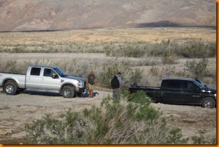
I heard voices about 0400 and in the morning saw this 2WD pickup stuck up to it’s axle in the loose gravel.  The neighbour was coerced into helping with the tow, and I lent my tow strap to the operation to get rid of a small group of stoned and/or drunk idiots.  At least they didn’t bang on my door (at 0400), or otherwise disturb me.

IMG_3712IMG_3713

And then we were on the road, after saying ‘so long’ to Nina & Paul who had the ‘beast’ parked just down the shoreline from me.

IMG_0428

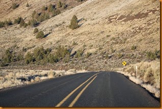
After a short back track on I-15 we headed over to Hwy 93 to begin the long trek northward for real.  Plans to stop again at the Pahranagat NWR were shelved when we arrived there around lunch time, so we just kept the wheels turning, turning left again onto the Extraterrestrial highway leading past ‘Area 51’.  A couple of alien craft disguised as dust devils tried to abduct us, but we managed to escape.

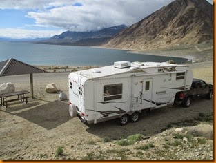
After re-fueling at Tonopah (and changing into jeans, with socks and a jacket, brrrr), we continued the northward trek, eventually pulling in to a lakeside rec area at Walker Lake.  This is just north of Hawthorne, which is surrounded by thousands of bunkers all over the desert … interesting!

(Check it out on Google Earth)
IMG_0432IMG_0429

Walker Lake has the appearance of a half-empty reservoir, quite common in the southwest after years of drought, but it is actually the remains of a vast inland sea.  The water level is constantly going down, and they have posted signs where the water level was all the way from around 1880 to present.

IMG_3727IMG_3725

Obviously, it is a challenge maintaining and extending boat launches here, much the same as at Lake Mead.IMG_3724

Ms Hailey heading home for some breakfast after a morning walk.

IMG_0433

From there it was north again to join Interstate 80 towards Reno where fuel was added again to avoid having to pay California prices on the next leg of the journey.  Nice to see Nevada had a nice free dump station at the rest area along the way.

IMG_3739IMG_3738

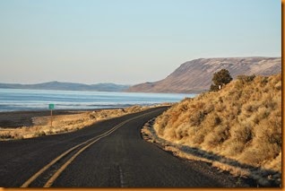
Temps were not that much above freezing along the way, and it was somewhat cloudy, but it was nice to get into some areas of pine trees, lakes, melted snow (!) and even some green grass!
IMG_3737IMG_3735IMG_3733IMG_3729

We made it across the Oregon line before needing to fuel up again, and pulled over along the shore of Lake Albert for the night.

Thursday, April 3, 2014

Stewart’s Point

If you want to know all about the ins and outs of camping at Stewarts Point on Lake Mead, within Lake Mead National Recreation Area, you’ll just have to cyber-transport yourself over to the Wheeling It blog, where Nina either has, or will shortly provide an excellent review of boondocking in the area.

Although I have camped in the area a number of times, I have never stopped in to check out the two ‘warm’ springs very close by.  They are Blue Point Spring, and Rogers Spring.  Blue Point is rather bland, with an unmarked trail leading back to a point where water gushes forth from a circle of brush, past a water survey flow guage. (Canadian spelling, eh), and an official benchmark.

IMG_3651

Just down the highway a ways to the south is Rogers Spring.  It sports a large shallow pond with little fish (and turtles, apparently?), several picnic shelters, and outhouses.  Water leaves the pond through a series of little concrete basins and waterfalls.  The sign says it produces 400 gallons a minute at a constant temperature of 80F.  But before you get tempted to go for a dip …

IMG_3663

… you have to read the second part of the sign.  That was enough to discourage me!

IMG_3662IMG_3660IMG_3657IMG_3656

Back onto the highway for a short tour, I saw a Nevada Wildlife truck towing a large boat towards Echo Bay launch, where I later came upon it again.IMG_3667

And sure enough, the boat was patrolling the Nevada side of the Overton Arm checking for anglers or other nefarious individuals near camp when I got back.IMG_3668IMG_3670IMG_3665IMG_3666IMG_3664IMG_3639IMG_3641IMG_3638IMG_3637

‘How people think I travel’

IMG_3282IMG_3284

‘How I think I travel‘IMG_0406

How I really travel.

IMG_0311